Skip to content

Home / Projects / Copper Road

RECLAMATION
HARD ROCK
Cu

Copper Road.

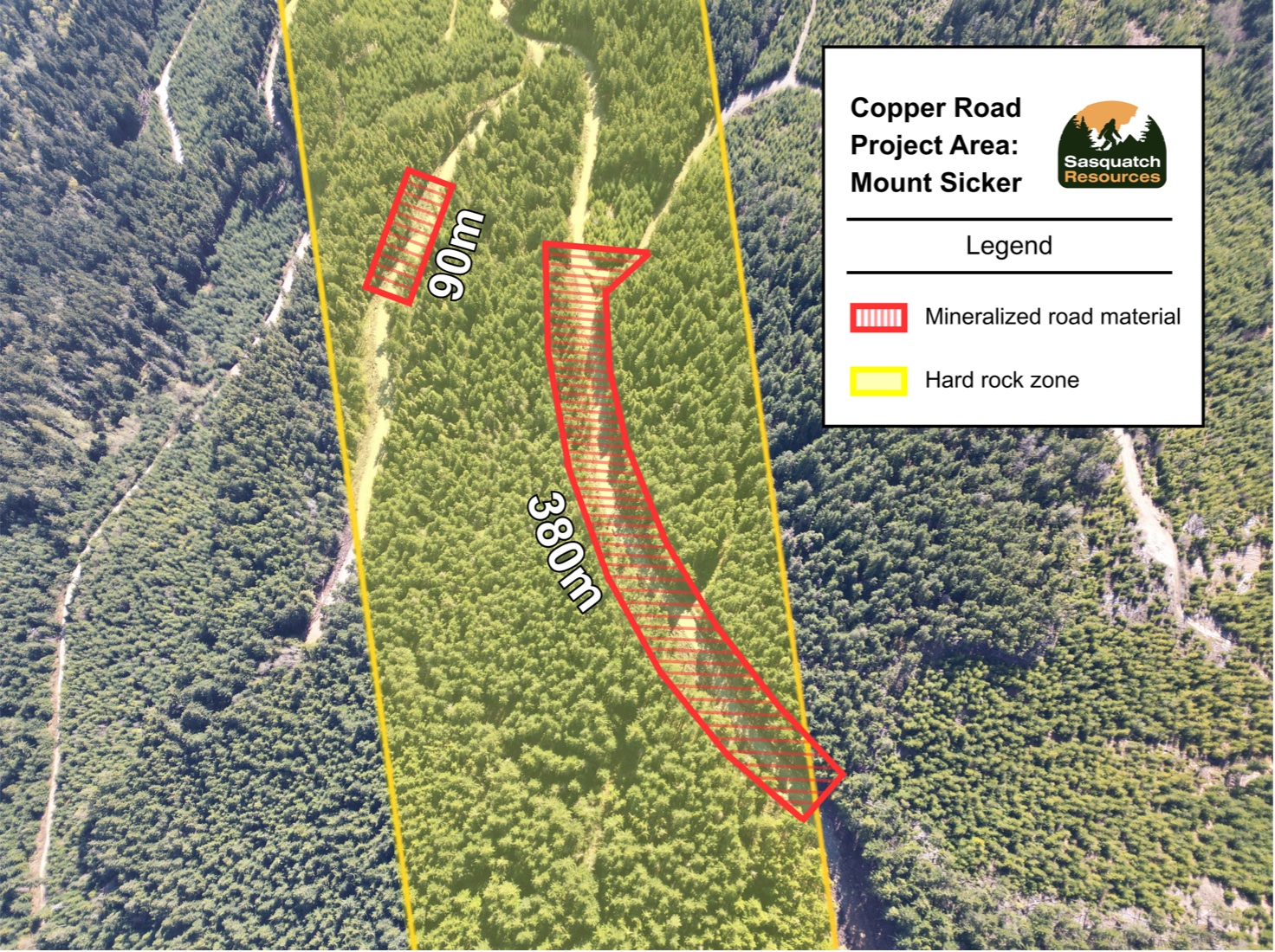
A near-surface copper system approximately 2km from the Mount Sicker waste site, with both waste rock and hard rock possibilities. Waste rock: a significant volume of high-grade waste, where a logging road was cut, and quite literally built, out of mineralized rock. Hard rock: substantial in-ground mineralization extending across both sides of the road, with future hard rock deposit potential.

2.36

% Cu
Channel avg., over 24.7 m

#1

anomaly
Largest target on the mountain

Permitted

1,000t
Trenching & bulk sampling

OVERVIEW

Copper Road.

Two to three kilometres from the original Mount Sicker workings, recent logging cut new roads straight through mineralized ground. The exposure sits on the largest geophysical anomaly on the mountain, with copper mineralization mapped from surface to roughly 200–250 metres.

Sampling of the road base: a 48-sample grid averaged 0.87% Cu.

Sampling of the adjacent hard rock: nine channel samples over 24.7 metres averaged 2.36% Cu.

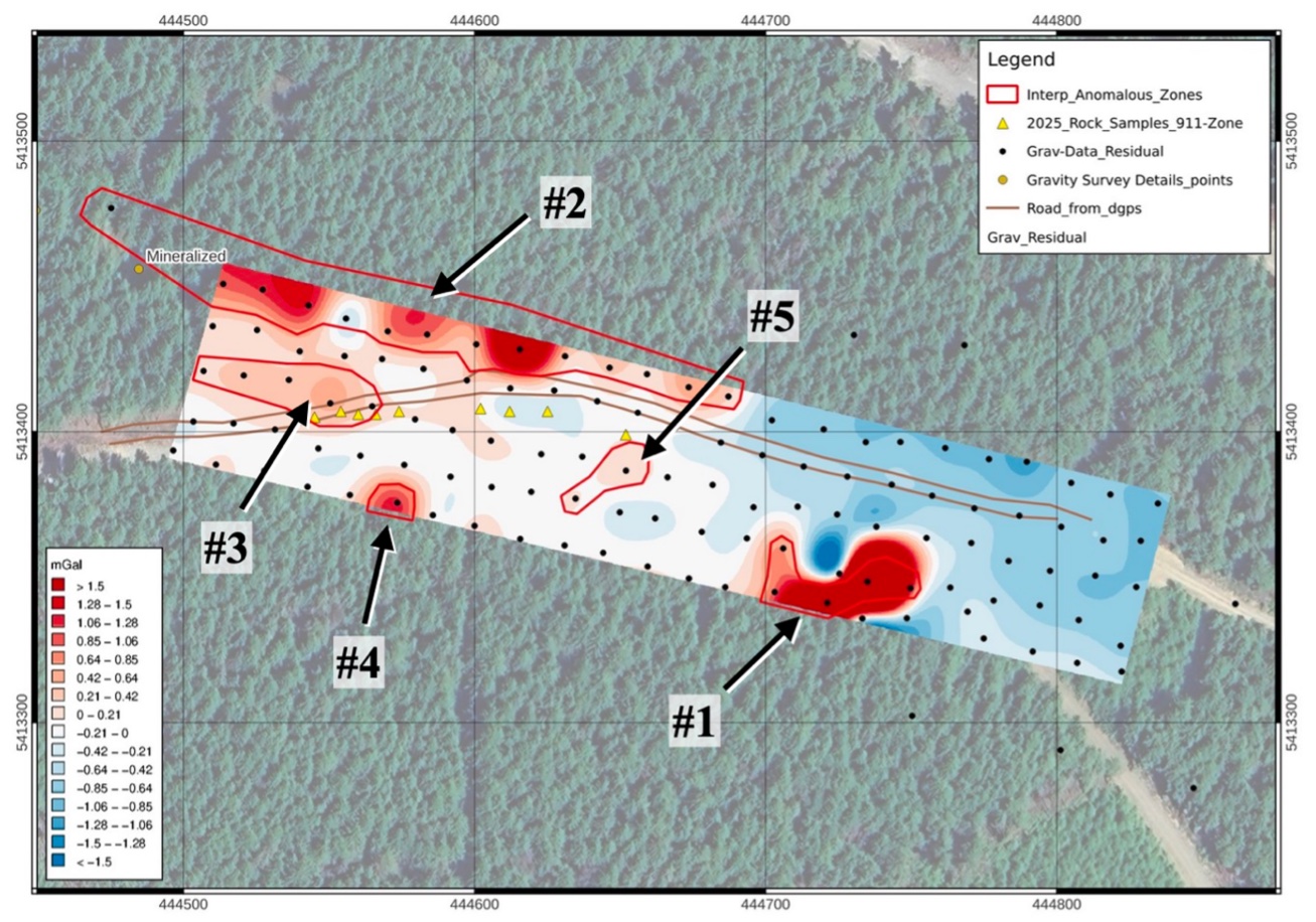
A trenching and bulk-sampling permit is in hand, and a 2026 gravity survey has shown a high-density anomaly.

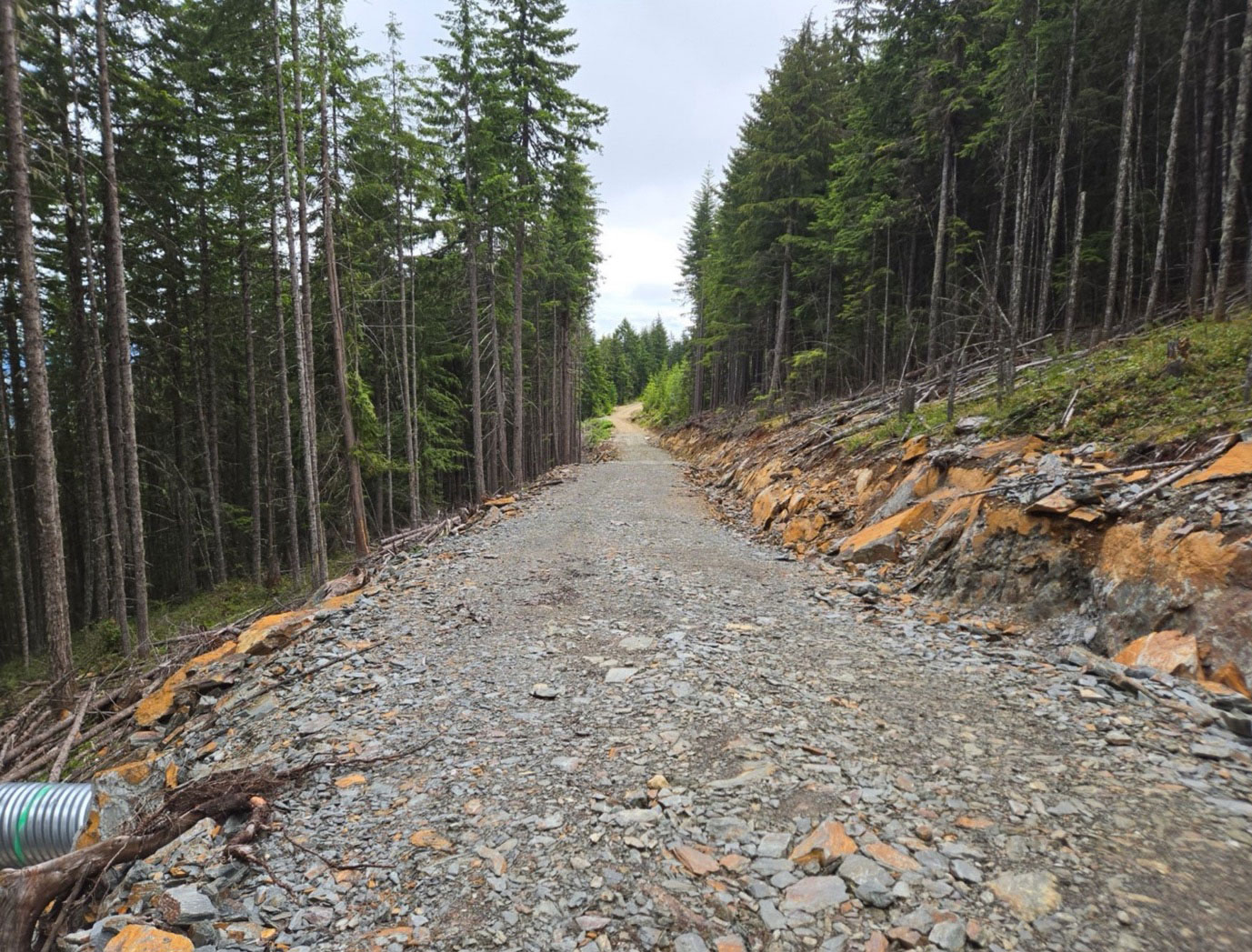
FIGURE 1 · COPPER ROAD
Cu
Mount Sicker area, Vancouver Island, BC
RECENT WORK

Progress highlights.

Since acquiring Copper Road in 2025, the Company has completed a grid sampling survey of the mineralized road material, channel sampling of outcrops adjacent to the road, and a geophysical survey of the hard rock zone as depicted below.

Map 1 – Copper Road project area
Map 2 – Interpreted anomalies from geophysical survey over Copper Road
RESULTS

Selected results.

Selected results from sampling and drilling across the project’s targets – for more detailed description of each program and their results, please refer to related news releases.

Grid sampling (on road base) WASTE ROCK
48 samples · average

48 samples
0.98 % Cu

Channel sampling HARD ROCK
9 samples over 24.7 m · average

9 samples
2.36 % Cu

Geophysical survey GEOPHYSICS
20m minimum survey limit · gravity (density) survey

5 anomalies
moderate-to-very high amplitude zones of significant size in/around road base

Surface, grid and channel samples are selective by nature and are not necessarily representative of the mineralization across the property. Geophysical interpretations and historic information remain subject to further verification. Technical disclosure is subject to the Company’s NI 43-101 reporting requirements.

RELATED DOCUMENTS

Reports, results & downloads.

Mount Sicker & Copper Road - 2025 Rock and Stockpile Sampling Results

December 2025 · assay data

Copper Road Geophysical Survey

August 2026 · geophysical survey

WHAT'S NEXT

What to expect.

Similar to what we have at the nearby legacy mine site, the high-sulphide waste at Copper Road is environmentally problematic. Once the Mount Sicker Project is permitted, it is anticipated that the Company will be able to tack-on the material at Copper Road, which would simply be sorted and removed from the site in the same manner. In addition, the area has shown significant potential as a future discovery, which could be explored further following the clean-up.

THE RECOVER-AND-REMEDIATE MODEL

A practical solution for a
century-old liability.